This spring, I will share some trails to impart new knowledge or perspectives. I hope you’ll visit them, learn something new, enjoy time in nature and leave with a desire to contribute to the future of your local parks and trails. You can find the series introduction here and another trail of interest here.
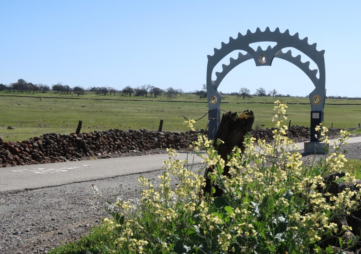
You could almost drive by the path off Skyway and not realize it was there. The only thing that indicates its presence is the giant, shining, metal sprocket archway that beckons bike riders — and driving passersby like me — to take a closer look.
Those who do stop will be rewarded. The trail, the Steve G. Harrison Memorial Bikeway, is straight and level, yet anything but ordinary. Not only does it reveal stunning biodiversity and local history while honoring a Sierra Nevada Brewing Co. executive, it also marks a boundary of the much-contested Valley’s Edge development.
While the paved trail is ideal for cyclists, it is also enjoyed by walkers, joggers and — according to several Google reviews — rollerskaters. The path has entrances off Skyway and East 20th Street.
What makes this trail interesting?
The most timely point of interest is the proximity of the bikeway to the Valley’s Edge development space.
It’s been impossible to drive or walk around Chico for the past few months without seeing signs at nearly every intersection or in front of many houses informing people to vote for or against measures O and P.
In simpler language, the vote was either in favor of or against the Valley’s Edge development, a neighborhood that would include over 2,000 homes and over 1,400 acres. Those in favor of the development cited the need for housing in the area and those against it primarily focused on the environmental issues around developing this land.
On the land plan and imagery map provided by Valley’s Edge, the Steve G. Harrison Memorial Bikeway is identified by name, as it marks an edge of the proposed subdivision. This prompted one Reddit user to fret, asking “What is Valley’s Edge going to do to the Steve Harrison Memorial bikeway?” As per the usual on Reddit, the question garnered mixed responses.
For now, the user doesn’t need to worry about change. On March 5, Chico residents went to the polls. At the time of writing the election results are still unofficial, but they show over 60% against both measures.
It doesn’t look like this area will be developed — at least not now, not yet.
What can you observe on the trail?
It is quiet. At the midway point of the paved bikeway, it’s easy to forget you are not far-removed from a busy roadway. In the distance, the buildings of the city can be seen, and behind them, the blue rise and fall of distant mountain ranges.
Closer, almost within arms reach, small details draw attention to biosystems as bustling as the city itself.
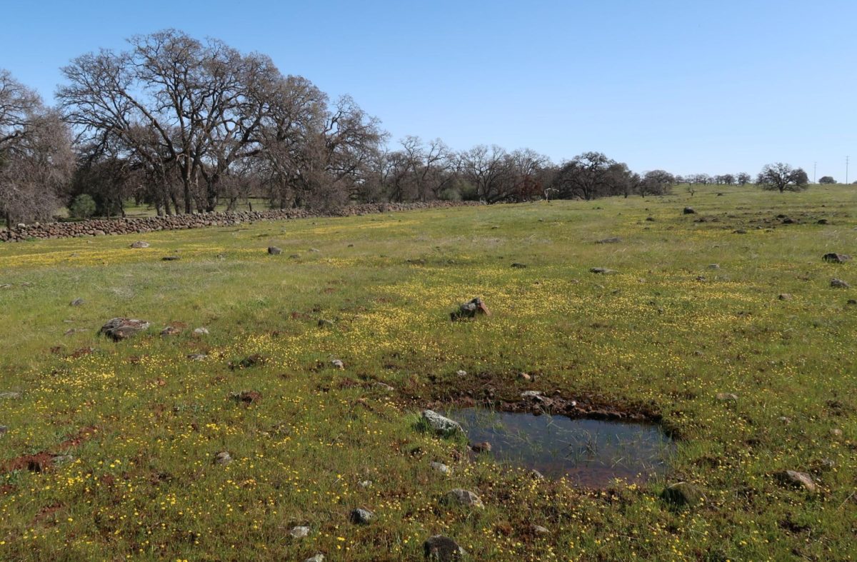
Pools reveal life too small to see through small ripples of movement. Birds announce themselves through rustles in the tall grasses by aging fence posts. Even more forms of life make themselves known through quieter, subtle noises, never revealing themselves visibly and leaving only speculation: was that sound a mouse in the rock walls? Or maybe a snake, or a lizard diving under cover from a sunny ledge?
Farther afield, cows graze and lounge in the sun, unbothered by the human presence on the trail.
On my visit, wildflowers were just beginning to appear. By the end of March, I would expect the fields to be a colorful patchwork. Even now, there are many vibrant hues, you may just have to look a little closer. I saw predominantly small yellow flowers, but also white and pinkish-purple, set against bright green grasses.
Opposite the side of the proposed Valley’s Edge development, a gate on East 20th Street held a sign for the Doe Mill Meadowfoam Preserve. Meadowfoam is an endangered plant found around vernal pools — ephemeral wetland pools that fill in the rainy season, but dry during summer and fall.
Writing about this rare plant, the U.S. Fish and Wildlife Service said, “It is only found in within a narrow 25-mile strip along the eastern flank of California’s Sacramento Valley in Butte County.”
The primary risks to meadowfoam’s survival they list include urban development, the drying of vernal pools from drought and/or climate change and the increase of non-native plant species.
Meadowfoam is rather small, and from behind the fence I can’t confirm whether or not it is a part of the flora I witnessed and photographed. Nevertheless, learning about this tiny, uncommon plant made me appreciate the landscape around me all the more. Hidden treasures lie everywhere.
History of — and on — the path
The path is a memorial for former Sierra Nevada Brewing Co. vice president – and the company’s first employee – Steve G. Harrison. Harrison, who died in 2007, was an avid cyclist, and an advocate for progressive causes and sustainability. The archways of the path are intended to honor his legacy and ensure he is remembered.
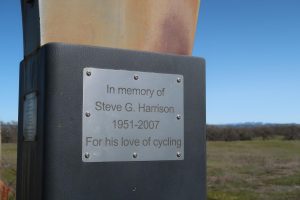
The metal arches were created by Chico artist and metal worker, Jeff Lindsay and donated to the city by Harrison’s widow, Linda Zorn.
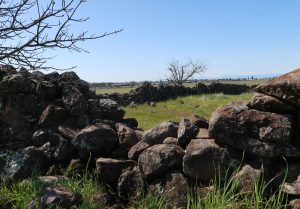
Beyond keeping Harrison’s memory alive, the bikeway also allows visitors to see a part of Chico history up close. Both sides of the path are lined with rock walls, constructed from the same volcanic stones that can be seen pockmarking the nearby fields.
Valley’s Edge stated, “Surveys reveal there are 34 hand-laid, stacked rock walls ranging from 65 feet to over 8,300 feet throughout the Valley’s Edge area.” The walls, speckled with lichen, have hills and valleys that echo the surrounding landscape.
The history of the walls can be hard to trace, as permits were not required and saved when many of them were likely built. Some could date back as far as the 1870s, and they still provide boundaries for the trail.
The sheer size and scale of the walls is almost unbelievable when considering the fact they were built by hand, with materials sourced from the surrounding fields. While the remaining walls that can be observed from the path are in varied condition, it is incredible to see how they have withstood time and weather.
Some practical notes
The bikeway is just that, a way for bikes to traverse the area. Regardless, it’s very pleasant to walk, I would simply recommend those who wish to visit without a set of wheels pay attention and step to the side when a cyclist is coming.
Not only is this polite, some of them are traveling at terrifying velocities, so it is probably smart for your own physical safety.
At the time of my visit, the path was relatively quiet and empty. Several cyclists passed, along with a very focused jogger. A woman entered the path via the East 20th Street entrance, walking her dog. Your furry friends are welcome on the path, as long as they are leashed and you pick up after them.
The bikeway doesn’t have tree cover, so in the dead of summer it may be too hot to walk comfortably. For a spring day, however, it was pleasantly warm. The wind can whip through with a vengeance, so it would be wise to bring layers.
The length of the bikeway is fully paved and flat, so it is very accessible for folks of a variety of abilities. It does not have bathrooms or water available. Parking is also limited.
I accessed the trail via Skyway. The trailhead is easy to spot because of the sprocket arch. If you bring your car, there is not much room to pull to the side for parking once you turn in, but it is manageable. The East 20th Street side looked to have even less space for cars.
The bikeway connects to other bike lanes, for those who want to cycle to it. The cyclists I observed entered from East 20th Street. On the Skyway side, the bike trail continues up the hill to Honey Run Road.
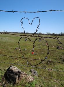
Final thoughts and perspective
Get out and observe natural beauty and life around you while you can. Our green spaces are shrinking for a wide variety of reasons.
For now, it seems like the land we’re referring to as Valley’s Edge will stay as it appears in the pictures attached to this story. But could that change in the future?
When I mentioned I was planning to cover this area, a family member was confused as to why. “Isn’t that area all flat?” she asked. “What is there to see?”
It’s not all flat, even the areas that look like they are have small rises and falls, and the thick grasses make it look like the fields are full of waves. What is there to see? A little bit of everything.
Being from Shasta County, I’ve long associated natural beauty with what I know: thick evergreen woods and mountain terrain. When I started commuting to Chico, I found the way the landscape changed along the drive to be interesting, but I didn’t fully appreciate it at first.
Over time, however, I fell as deeply in love with the grassland around Chico as I am with the mountains around my home. I especially enjoy driving through the Vina Plains Preserve just outside the Butte County line. Every season transforms this stretch of land.
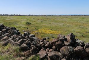
The grasses sprout, grow and brown. Rain fills previously hidden streams and pools. Flowers rise and fall. Raptors often perch on the fences and poles. Herons sometimes pick their way through on long, spindly legs.
Sunsets on the plains are the most beautiful I’ve ever seen. Even on drives after a long day, it lifts my spirits to see the changing colors of the sky and clouds, and the gentle movement of the wind through the grasses.
I see the same beauty along the Steve G. Harrison Memorial Bikeway. Nature, in its largest and smallest forms, is on display.
So go see it, be familiar with the area you’re probably tired of hearing about. And even more — go appreciate it.
Heather Taylor can be reached at orionmanagingeditor@gmail.com.


