Fire danger remains high in NorCal
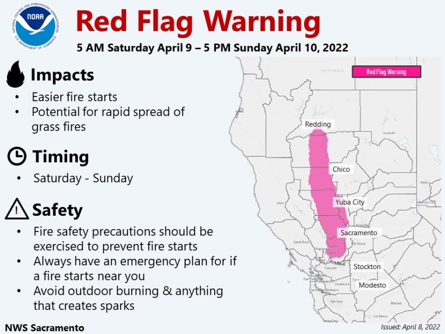
A graphic provided by NWS Sacramento
A historical early-season red flag warning remains in effect for most of the Northern Sacramento Valley, and parts of the Bay Area until Sunday afternoon. It comes amid record-shattering high temperatures across California, exceptional drought conditions and critically dry vegetation across the region.
This is the earliest red flag warning that has ever been issued by the Sacramento office. The previous record was May 1, 2021.
High winds sustained between 20-30 mph with gusts up to 50 mph have been recorded. Minimum humidity values between 6-12% for the rest of the day, with poor overnight recovery Saturday night.
The area of most concern is the west side of the Sacramento Valley, particularly areas west of Interstate 5 and Interstate 505. The combination of high winds banking along the leeward side of the Coast Range, along with low fuel moisture makes this area the most concerning.
NWS Sacramento released an urgent fire weather message late Friday morning, warning of abnormally high fire danger due to unseasonably warm and dry conditions, combined with the forecasted high winds. This combination could support large or rapid fire spread — which could lead to extreme fire behavior.

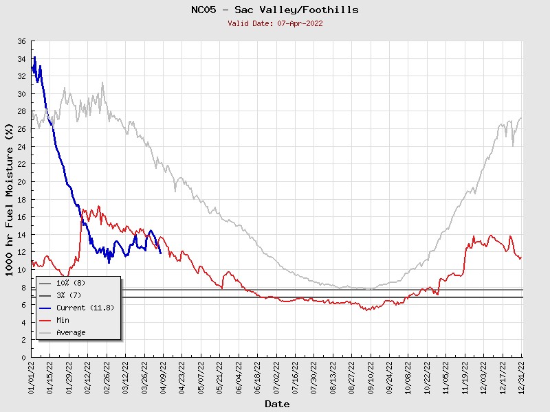
The latest data provided by the Northern California Geographic Coordination Center (North Ops) paints an alarming picture, as fuel moisture in the Sacramento Valley and Foothills are at record levels. It’s nearing levels typically seen during peak fire season here in the North State.
A return to cooler and showery weather is expected by Monday and Tuesday, which will significantly reduce fire concerns. However, the long term is still bleak for an early start to a significant wildfire season.
Michael Steinberg can be reached at [email protected] or
@MichaelWX18 on Twitter.


