
A substantial heatwave is forecast to impact the entire West Coast late next week, especially in hard-hit California. Chico will see temperatures above 90 F on Wednesday, Thursday and Friday, making April feel like mid-July for Wildcats.
This comes after last week’s storm, which impacted the state by giving us some much-needed rain. While the precipitation was nice, it made little to no difference in delaying fire season, especially in the North State. Whatever moisture is left in vegetation will be significantly impacted by these extreme temperatures, making already record-high fuel flammability even higher.
The newly released fire season outlook by Northern California Geographic Coordination Center (North Ops) looks bleak, again.
The latest discussion predicts that our significant fire potential, which is the probability for large wildfires, will increase above normal in May. This comes after the previous outlook predicted the increase in June. This one-month jump is thanks to the near-to-above normal temperatures and near-to-below normal precipitation levels that are expected.
Unfortunately, our dwindling snowpack will also be taking a big hit too, as towns in the Sierra-Nevada will feel the heat. Blue Canyon, located four miles southwest of Emigrant Gap, is forecast to be in at least the low to mid 70s. It lies at an elevation of over 4,500 feet.
The most recent data released by the California Department of Water Resources shows the Northern Sierra/Trinity snowpack at 28% normal for the calendar date April 1. It’s well below the average of where we should be. The Central Sierra is slightly better, coming in at 42% of average, while the Southern Sierra sits at 43% of average. For the entire state, we are at 38% of average.
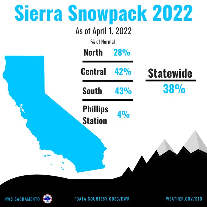
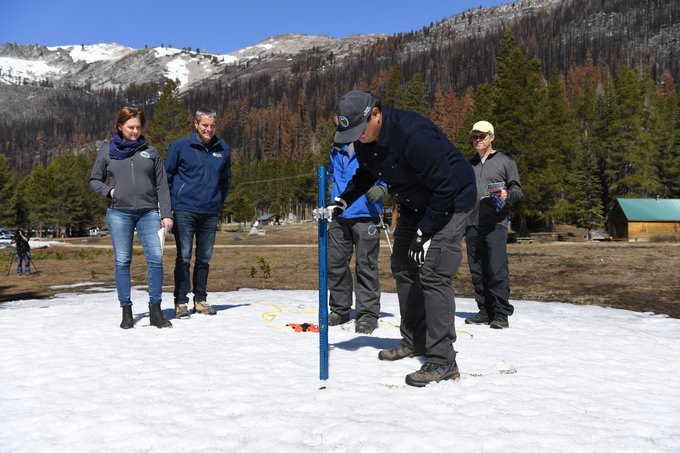
It’s alarming to see these numbers already, as this is the time when the Sierra is at its deepest for snowpack. At their official recording site at Phillips Station, it came in at 4% of average.
Luckily, the heat will be with us for only a few days, with temperatures next Saturday cooling to around 80 F, then possibly dropping off even more after Sunday. Weather models have been hinting at another low-pressure system impacting the region the following week. Granted, it’s still too early to determine anything in terms of rain and snow totals, but the models showing a possible cooler solution is a lot more positive than a prolonged heat spell.
However, it will be short term relief at best for the overall trend that the year has shown. It will be a very long summer once again, with water in high demand and strict restrictions in place.
Michael Steinberg can be reached at [email protected] or @MichaelWX18 on Twitter.